Wolf Trap 2020

April 11th, 2020

Today was forecast to be a really nice day, so I decided I’d try again to make it to Wolf Trap light from Gwynn’s Island after my previous attempt was cut short by some serious fog. I’ve also made a few improvements to the boat which I wanted to test. I epoxied in two additional belaying pins and welded up a stainless catch for the centerboard rod.

I won’t keep you in suspense, I did make it and here’s my GPS track. It was a 21.1 mile trip!

All loaded up and ready to head to Gwynn’s Island. I get some strange looks when I pull in at the boat ramp beside a row of lifted F250’s pulling 300hp center consoles. Clearly I’m in the wrong line of business.

I launched right at low tide and I was a little worried I wouldn’t be able to get to Rigby Island since it’s so shallow. Fortunately I could rely on a rising tide throughout the day and hopefully a boost on the return trip.

This time I did a better job of brailing up the sail. I think some bungie cords might be easier to use rather than wrapping the brail line around everything. I’m starting to get better at getting everything rigged and launched without incident. From arriving to launching took 40 minutes.

Heading away from the ramp on a run. My mother was a postmaster on Gwynn’s Island and she’s told me stories of how that swing bridge would sometimes stick open. One time it jammed just before a hurricane arrived and she was worried she’d have to stay in the post office. But fortunately they got it closed again.

Towards the bottom of Gwynn’s Island I saw a number of watermen checking crab pots. Growing up I used to think I wanted to work on the river, but I bet the freezing cold or sweltering hot days would outweigh the nice days.

Heading towards Rigby Island. It was somewhere along in here where I heard an unwelcome grinding sound emanating from the centerboard. The boat speed also seemed to take a hit. Looks like I was running out of water! I need to get a jam cleat and mount it to the centerboard cap for the downhaul. Currently I just tie the line around the thwart, but that makes it hard to get the board up in a hurry.

The sandy part of the island is so low that I was having a hard time seeing it and I strayed into a shallow area. I made a turn towards shore because most of the houses had docks, so I assumed there was deep enough water.

There are a lot of sandbars in this area and with the low tide they were just barely submerged.

Navigating by the color of the water. The sandbars seem to be pretty sharply defined though.

Heading out into the bay. I found a row of PVC pipes marking a channel between islands so I followed it out rather than follow the shore further south.

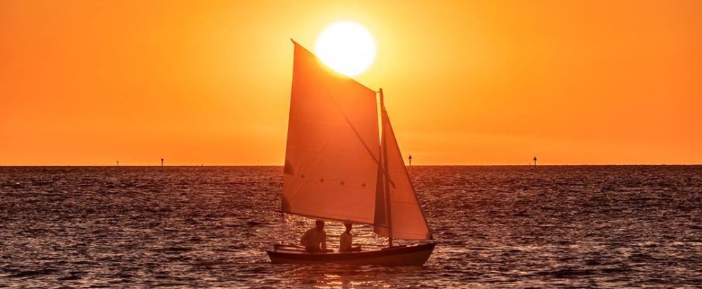
There’s Wolf Trap light on the horizon! It’s a little over 5 miles away. As I got away from shore the wind started picking up. The waves were the biggest I’ve had the boat in, maybe 3′ at times but the majority were probably 2′. At one point I had waves coming from two different directions and the wind from a third… so it was an adventurous trip. The boat really handled it well.

Eventually I made it to the lighthouse. I wanted to circle it, but the wind shifted so I’d have to beat directly towards it. Everything was making me start thinking about heading back, so I decided to turn around. Maybe another time. These pictures really don’t do the waves any justice.

Aiming at what I thought was Stingray point just north of Gwynn’s Island but it turns out that was actually Windmill point. I was a little over 20º off of where I should have been going.

After checking my phone I realized I was about to miss my exit.

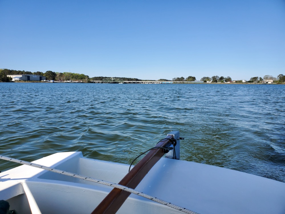
Heading through the hole in the wall wing and wing. Despite being ~30 yards wide in places the channel was well marked. I’ve been thinking about making a tool that is a combination whisker pole, boat hook, and mounts to the rudder head to support a tent’s ridge line.

Nearly back to the ramp. I went 21.1 miles in 5.5 hours with an average speed of 3.9mph and a max of 6.8mph. I think I need to get my GPS tracker to take more finely spaced points. It’s currently set to take a point every 2 seconds, but I can’t believe 6.8mph is the max I hit today.


Gwynn’s Island 2020

Gwynn’s Island 3/29/20

I’ve slowly been making improvements to my boat over the winter and today, in the interest of our national wellbeing, I decided to practice some social distancing out on the water. And as a completely unrelated benefit, I got to test how well my improvements work.

Previously, every time I’ve launched I’d get blown into the dock while trying to rig the sails. It’s been frustrating and I finally decided to rig a brail line that bundles everything up into a neatish package. My plan is to rig the boat in the parking lot, brail up the sail, and launch the whole thing ready to go. Then I can row out to deeper water, let the sails down and start sailing. Hopefully this will improve the lifespan of the paint on my gunnels.

Now that spring is finally here, I’ve been watching the weather looking for a nice day. The water is still ~50º, so I wanted easy wind, nice air temperatures, and a protected area to sail. Today was forecast to be 10-15mph wind and 80º temperatures, so I set out to a nearby boat ramp on Gwynn’s Island. This island offers a 2.5 x .5 mile strip of water that is ideal. One note if you ever go to this ramp… there are power lines across the parking lot, but there’s plenty of room to maneuver around with the mast up.

My general plan for the day was to sail to the southern part of the island and if everything was going well, continue on to Rigby Island which is all that’s left of a whole line of sandy barrier islands that stretched south. I wanted to scope it out as a potential stopping point on some future camp cruising adventure. After Rigby Island I would consider sailing out to Wolf Trap Light, assuming the conditions were good. Wolf Trap Light is caisson lighthouse about three miles off the coast. From what I’ve been told, the HMS Wolf ran aground there in the late 1600’s, so I guess it’s a Wolf trap! After returning from the lighthouse, I’d take “the hole in the wall” which is a narrow channel between the sandbars that used to be barrier islands. I figured this would give me a good opportunity to practice aiming for a precise location and trying to find it with little in the way of landmarks. The entire trip would be about 20 miles.

My planned path.

However, even the casual observer will quickly see by my GPS path that I didn’t quite make it. Best laid plans…

GPS track

It turns out the warmer air brought a ton of fog because the water is still cold. Advection fog it’s called according to Wikipedia. The 80º weather and 10-15 mph wind didn’t quite make it, although it was a nice 70º day.

Anyway, I got to the ramp around 10am and started rigging the boat in the parking lot. It took about 30 minutes, but I did have some trouble with the brail line tangling up which required me to raise and lower the sail a few times. But eventually I got everything sorted and got the boat launched. Based on the conditions, I’m pretty sure the passerbys thought I was a fool.

The bundle could be neater, but it worked well. The framing could be better too… Totally didn’t notice the reflection in the water when I took the picture.

I rowed out a bit, dropped the sails and rigged the sheet. Much better than trying to do it while banging into the dock! The next problem was the rather concerning lack of wind. There was just a hint of breeze and I started heading towards the bay. I soon began wondering why the boat seemed to crab across the water when I realized I’d forgotten to put the centerboard down. That helped things considerably.

I drifted and sailed along for a little over an hour, in and out of the wind shadow of the island. Things would pick up as I came to the mouth of a creek, then slow down when I was closer to land. I tried every light air dinghy sailing trick I knew, although that was limited to sitting on the leeward side and the occasional wiggle of the rudder to see if that made any improvement. I thought about the oars, but this is my yacht and I’m a proper yachtsman, not some galley slave! Eventually I resigned myself to watching nature go by. Ducks paddled away, a pair of Canada geese honked as they changed course for me, an osprey flew by with a stick, fish splashed out of the water, a waterman cussing his outboard echoed out of the mist.

A pair of ducks that seemed a bit alarmed by their sudden change of pace.

Towards the bottom of Gwynn’s Island I watched a ripple of wind coming and the sailing picked up. Once I was out of the wind shadow of the island the boat speed increased to 4.5-5mph which was a welcome change. It’s nice hearing the gurgle of water and seeing a trail of bubbles off the transom.

The fog that was supposed to burn off before I even arrived at the boat ramp was still hanging around and there wasn’t much to see, so I started following lines of crab pots.

For a while the fog was getting lighter, but it soon changed to thicker than when I left. Before I could see 4-5 crab pot floats, now it was down to 1 or 2. I made the executive decision that if things hadn’t noticeably improved by 12:45 I’d head back. Not because I had any misgivings about the boat, just that it was getting a little boring seeing just a patch of water and then nothing.

The theme from Master and Commander started playing in my head.


Shortly before my self imposed deadline a buoy materialized out of the fog. This is the buoy that marks “the hole in the wall”. I decided that this was a decent accomplishment for the day and I’d turn around here. On a side note, I need to do something about all the lines up by the mast. I think I’m going to add two more belaying pins because currently I have two or three lines per pin and it’s a bit of a mess.

On the return trip I decided I’d try to steer straight runs with the compass, then check the GPS track and see how I did. I did a 180 and headed back to the ramp. So far navigating has been with Google maps on my phone to get an idea of where I am, and then trying to hold a course with the compass. It worked ok and I never felt like I was lost. Also I’m happy to report that my little hook to hold the snotter is working great and I no longer have creases in the sail.

After a while I started seeing trees in the fog and found my way back to the ramp.

By this point the wind had picked up and brailing the sail while on the water was a little exciting. But it worked ok and I rowed the boat back to the ramp. After pulling the boat out and getting everything unrigged, the fog started to lift. Go figure!

I recorded my GPS track to analyze. I averaged 3.6mph, had a top speed of 6.1mph, and spent nearly 2.5 hours on the water. The entire trip was 5.6 miles. I’m not good at estimating windspeed, but if a nearby weather station is to be believed, the wind was somewhere around 5 knots. Steering a straight line with no landmarks was harder than it sounds, but in my defense I was taking pictures. At least that’s my excuse and I’m sticking with it.

So while I didn’t accomplish anything I set out to do, I did confirm the brail line setup is the way to go and I got a lot of confidence navigating in fog. I never once felt uncertain about the boat’s capability which is turning into a welcome theme every time I take it out.

Grog Island ~2004

Growing up my father worked with the local Kiwanis Club which sponsored a Boy Scouts explorer program called Sailing Explorer Post 290. They would take kids out in Rainbow 24s to race, daysail, or go on overnight camping trips to a little island called Grog Island. I was a bit young while these adventures were going on, but I always knew I’d make it out there one day. In 9th grade I bought a 1977 Sunfish and after getting a bit of sailing experience I decided my first long daysail would be to Grog Island.

Grog Island probably in the 90’s (Source)

Unfortunately in 1999 the storm surge from Hurricane Floyd accelerated the slow erosion of the island by killing the pine trees holding everything together. When I arrived it was a sandy island just a few feet above the water with a couple sickly pines still hanging on. Most of the larger trees had fallen over like a large game of pick up sticks. By 2010 or so Grog Island had washed away entirely.

I’m pretty sure my trip was in 2004 or possibly 2003.

I grew up near Mosquito Creek although we weren’t on the water ourselves. I did yard work for a neighbor and he let me use his dock to launch my canoe and sailboat. He even let me take his Boston Whaler Super Sport out if I wanted.

My trip was about 20 miles over 8 or 9 hours and the wind was southerly all day.

On the day of the trip I launched from his dock around 8am and headed down Mosquito Creek and made a left at Mosquito Island. I remember I stayed close to shore and cut through the shallows halfway to Windmill Point before rounding the point and heading north west toward Grog Island.

I think I had a little trouble finding the island since it was low lying and blended in with the background. I know I had a military surplus lensatic compass my father had given me and a map I’d made from screenshots of a USGS topographic map painstakingly pieced together in Microsoft Paint. I doubt I really knew how to use the compass and I probably just tried to keep sailing in the same direction of Windmill Point’s shore. I do remember this leg was idyllic downwind sailing and I spent a long time sitting on my life preserver in the footwell with my legs dangling off the side, steering with the tiller over my shoulder.

I’m pretty sure I got the screenshots from a website called MapTech that had an online viewer to show map samples. I found a modern version of the same map here.

Eventually I found the island and beached my Sunfish. I remember walking around looking at the huge dead trees that had fallen over and eating a soggy ham and cheese sandwich I’d packed that morning. After scooping up some sand in a plastic bottle to prove I’d been there, I headed home.

This leg was upwind and rougher since the wind had picked up, but fortunately I could lay the course to the point without tacking. I remember feeling a bit overpowered with that big lateen sail… The waves at the point were pretty short and steep since it’s so shallow through there, but eventually I made it around to a beam reach back to Mosquito Island. The wind had gotten stronger with scattered white caps and just as I was about to turn right and head for Mosquito Creek I saw my dad and neighbor speeding out on his Grady-White cabin cruiser Taittinger. They gave me a wave and turned back. I later learned mom was terrified I was lost and sent my unconcerned and slightly annoyed dad out to look for me.

Taittinger

Eventually I made it home worn out and pretty sunburnt, but I guess this trip was the start of looking for a better boat to do similar adventures in!

A different trip many years later, but this was my Sunfish.