Ocracoke 2021

A week at Ocracoke

In mid September my wife and our parents went down to Ocracoke Island for a week long vacation. We stayed in a cottage on Lighthouse Road and had access to a dock at the southern end of the harbor, so of course I brought my sailboat. It was a pretty windy week, but I did manage to get out on a long daysail.

Heading across the Hatteras Inlet on the ferry Frisco. This one was built in 1990 and must have recently been painted because it was looking pretty good. Along the way we passed the Ocracoke which was built at the same time and it was looking really rough, kinda had the HMS Hermes returning from the Falklands vibe.

September 19th, 2021

Getting everything rigged at the boat ramp. This is were I first launched the boat on a vacation in 2019. I was still mounting deck hardware the night before we left and I didn’t even have time to test it out. Thankfully I’m much better prepared this time.

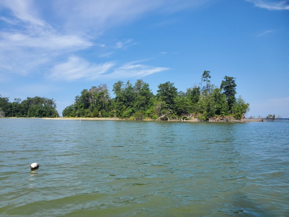
Sailing around to the entrance of Silver Lake. Apparently this harbor was just a shallow creek when Blackbeard was here in the 1700’s and it was later dredged out during the 1930’s and again during WWII.

Our cottage provided dock space at the southern end of the harbor. I need to improve my docking setup… I rarely dock so it’s always a bit of an afterthought. The cleats on the quarters are fairly small since they usually only hold the sheet traveler.

September 21st, 2021

Tuesday looked like it’d be the best day for sailing of our trip, so I planned out a 30 mile trip to Hatteras for lunch. Then I’d return through the ferry channel and land at a beach off Prong Road on the sound side near the ferry docks. Then my folks could pick me up with the trailer and take me back to the village. The wind was forecast to be from the south east, but it ended up being more from the east, so I didn’t quite make it! I ended up going 41.6 miles to nowhere in 8.5 hours.

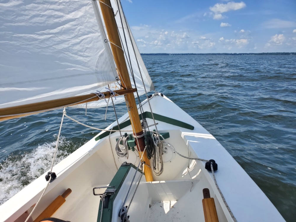
I had a nice wind blowing away from the dock, so I wrapped the painter around a pile, cleated it off, and drifted out a bit to raise the sails. After I let the painter go I made a few laps around the harbor while the 7:30am ferry to Swan Quarter got going.

Didn’t want to try squeezing through the entrance with him!

Once outside the protection of the harbor I found the wind a bit too strong so I hove to and put in a reef. This was the first time I’ve reefed on the water and it worked pretty well. It might be a different story if the waves were bigger, but I’m pretty pleased with my method of reefing a spritsail.

While I was hove to I drifted towards Howard’s Reef and due to the angle of the wind I couldn’t make my planned route. While I was considering my options it got pretty shallow and my rudder popped up into barn door mode. I saw some piling which I thought might be a bit of a channel, so I decided to see if I could sail over the sandbar and into the Pamlico Sound. I could always turn around and head out on a run and go around the spoil island.

I drifted north about a third of a mile while tying in the reef and there was a bit of off roading required to get over the sandbar.

I had to pull the boat through 2″ of water for about 200 yards. I removed my drybag, bilge pump, and battery but it didn’t seem to do much. It also didn’t help that the tide was falling. I kept reminding myself that the Greeks managed to pull triremes across the Isthmus of Corinth along the Diolkos and eventually I made it through to deeper water.

I spent 3.75 hours pounding upwind at 5 mph. There were some big waves at times, but nothing too scary. I decided to abandon my attempt to reach Hatteras for a few reasons, although I probably could have made it. Through some vague texts and a garbled phone call I got the incorrect impression that my parents wouldn’t be able to pick me up at the point, but the main reason was a small craft advisory was set to start at 5pm and I wanted to be off the water well before then.

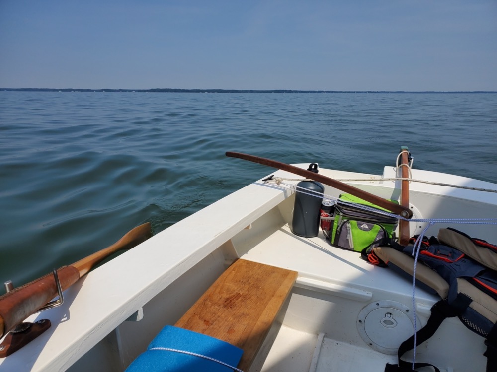
So I turned around and started back on a broad reach. For two hours this was a really fun ride at 6 mph. I’ve finally figured out a good way to store my oars and keep them from rolling around. I drilled a hole through the deck carlin and semi bulkhead to rig up a loop of line that I slide the blade of the oars through. Really simple and works well.

As the village came into view the temperature dropped and the wind picked up. I averaged 7 mph and even with the reefed main I needed to hook a foot under the thwart and hike hard.

Once I got to the spoil island at the end of Howard’s Reef I hit the roughest conditions I’ve ever been in. The wind was howling and waves were popping up in a random frenzy with no pattern that I could see. At one point the bow punched through a big one and my coaming did little to help. For about 10 minutes I averaged 8 mph with a few bursts above 9. Lots of hiking and letting the sail luff.

By now the wind had shifted to the south east so I had to tack my way in. The first leg after the spoil island was pretty rough, probably because I was right on top of a shallow area. About halfway to the harbor I felt like I was able to breathe again.

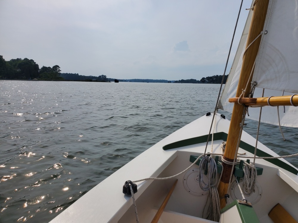
Finally lined up with the entrance to the harbor. The current through here was incredible… I had to point 10º to leeward just to go straight which felt completely wrong.

I only recently found these graphs on NOAA’s website, and it predicts about a 1.75 knot current in exactly the direction I was being carried.

As I was coming in my lovely wife snapped a picture as I passed the schooner Windfall II heading out on their daily sunset cruise.

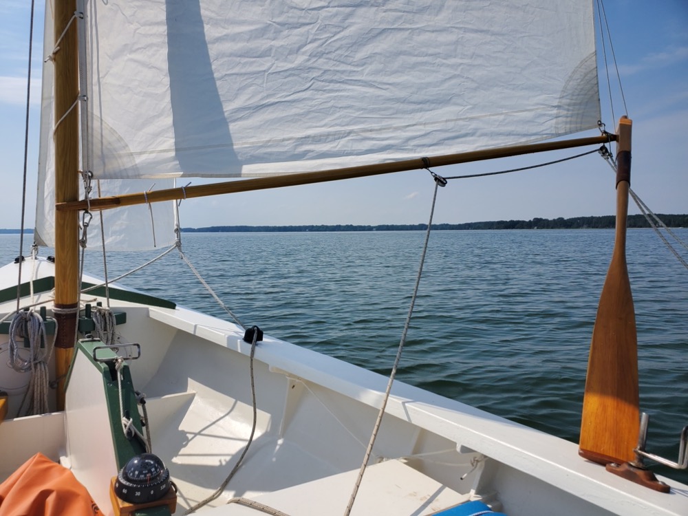
The main has some wrinkles that I wasn’t quite able to get out, but overall I’m pretty pleased with how it sets reefed. I added a part to my snotter tackle, so I can now tension the sail from the cockpit. Previously I needed to go forward and sweat the line. It does add some complication to the setup but the adjustment is worth it.

Here’s how I usually approach a dock. First take down the jib and stuff it along the port side of the centerboard case. Then scandalize the main to reduce power. Get yourself pointed into the wind again and then take it all down, keeping the heel of the sprit off the deck. The sprit will project forward a few feet of the bow if you don’t loosen the peak pendant, but that’s ok. I tie the sprit to the mast with some light line to keep it from rolling off the deck. And I try to do as little of the large picture as possible.

September 23rd, 2021

On Thursday I woke up at 6am to roaring wind and tons of rain. According to Windy it was 25 mph with gusts up to 30. I drove down to the dock to make sure everything was still ok but by the time I got there the squall was through and the rain had stopped.

The boat was still there and my bilge pump seemed to be working. It leaves a fair amount of water in the bottom since there’s no real bilge and there’s quite a head of water in the hose going over the gunnel, but it kept the water low enough that it didn’t seep through the inspection hatch on the front of the sternsheets. I plan to get rid of that hatch this winter and put a big rectangular one under the tiller. Should be more useful and I don’t sit there anyway.

I forgot to bring some bolts to attach the bilge pump wires, so I whittled a point onto some sticks and wedged the wires in place. I figure wet weather will just improve the connection as the wood swells!

September 25th, 2021

Saturday morning it was time to head home and my mom and mother in law wanted a ride. Unfortunately the wind was blowing me onto the dock and it was just too crowded. I’m beginning to think the First Mate is really a one person boat, at least with inexperienced passengers. You know, building a bigger boat would be one way to fix this problem…

Sailing wasn’t going to work, so I rowed the .8 miles to the boat ramp. Just as I rounded the corner and entered “the ditch” I saw the Swan Quarter ferry in the distance. I picked up the pace and we snuck out a few minutes before it came through.

Approaching the boat ramp, it was upwind the whole way. Then it was time to pack it up and head home.


Cape Lookout 2021

August 28th, 2021

My wife and I took a vacation down to Atlantic Beach which is on one of North Carolina’s barrier islands. We usually go to Hatteras or Ocracoke, but this year we thought we’d try somewhere new. I have a thing for photographing lighthouses as an excuse to get out and explore, so we decided somewhere within sailing distance of Cape Lookout would be interesting. The morning started out with pretty light winds from astern. I really could have used my topsail I’ve been tinkering with, but it’s not quite ready for prime time yet.

Leaving Anchorage Marina. Pretty narrow through here, especially under oars.

Heading across Beaufort Inlet with the Atlantic off to the right. The number of boats that passed me was incredible, and it only got worse throughout the day. Boat wakes came from all directions and the channel was pretty narrow in places. Fortunately it was all downwind and the wind was predicted to shift to a beam reach on the way back.

On the sound side of the uninhabited Shackleford Banks. After bouncing through boat wakes I decided to raise the centerboard, let the rudder pop into barn door mode, and cut through the marshy islands. This not only gave me interesting things to look at and navigate around, but it also massively cut down on the number of other people.

Although not everyone… this guy was out buzzing boaters in his Jet Ski of the sky. He didn’t get super close to me, but my wife got a video of him flying down the beach.

What I thought were watermen off in the distance turned out to be feral horses grazing in the marsh! Supposedly they came from Spanish or English shipwrecks during the age of discovery and genetic testing does seem to indicate their line dates back 400 years. I was feeling pretty lucky to see them, but after sailing further I saw tons more all over the island. Must be a tough life eating marsh grass and drinking brackish water.

Heading through some marshy islands in a foot of water. One guy who was anchored said he didn’t think I’d make it through.

Working my way over to Barden Inlet through the shallows. Powerboats ripped through at full speed, so I guess they must know where they’re going. Shackleford Banks used to be connected until a hurricane opened this inlet in 1933. Congressman Graham Barden sponsored legislation requiring the Army Corps of Engineers maintain the channel for the watermen of Harkers Island.

Heading toward the lighthouse! The beach was packed with anchored powerboats and more were constantly coming or going. I picked the widest spot to beach my boat and went for it.

Aways out I dropped the jib and sailed in on the scandalized main. Luffed up into the wind right at the shore, hopped overboard, and pulled her up onto the beach like I knew what I was doing. Just then I noticed a group of people coming over to give me a hand… but it turned out they just wanted selfies with the boat and to ask how it can move without an engine.

A pretty packed beach.

The Cape Lookout Lighthouse was built in 1859 and is 163′ tall. The black diamonds are oriented north and south, while the white diamonds point east and west. I wanted to climb it, but it’s closed for the foreseeable future while serious structural issues are fixed.

After eating lunch I managed to get launched without ramming anyone else’s boat or more importantly looking like a fool. Once away from the shore (and during a brief lull in passing boat traffic) I peaked up the main and hoisted the jib.

It took some tacking around the shallow areas to get into Lookout Bight. The shoreline was packed, boats were crisscrossing everywhere, and some pretty big ones were in the channel.

But eventually I made it into the Atlantic where I hoped I would just have to deal with the wind and waves… but that was not to be the case. At one point a charter fishing boat blew past close enough for spray to hit me and I had to quickly turn into his wall of a wake. And unfortunately the wind didn’t quite shift enough for a beam reach, so it was all upwind.

I stayed within 3/4 of a mile from Shackleford Banks and it was a choppy ride. There seemed to be waves radiating out from the beach which I assume are reflected waves, although maybe they were just from the constant boat traffic. Possibly further out would have been less chaotic. I never felt close to being in over my head, but the constant bashing to windward did get tiring.

Heading into Beaufort Inlet. The waves through here were even choppier with some of them constructively interfering to get pretty big. At one point I looked up at a wave for a moment, but that was not the usual size. My GPS tracker shows I surfed another wave upwind at 8.5 mph.

I didn’t have enough hands to take many pictures from the narrow section. Mostly because I was trying to navigate upwind through a narrow channel while over canvased and surrounded by tons of boats. It was ridiculous how many there were… I felt like I was surrounded by TIE fighters in a Star Wars movie.

Once through the narrow section it opened up and I could tack over to the marina. It was blowing pretty good, I think because the land funneled the wind in. Although my wife did say the wind got a little uncomfortable out on the beach too.

Finally back at the ramp after 32.7 miles. I averaged 4.5 mph on the way back and I had about 5 gallons of water sloshing around in the bottom just from spray. The whole trip took 8.5 hours and was a great success. Did I mention there was a ton of boats to avoid?


Bridge Cam 2021

August 22nd, 2021

Today I went on an 18.3 mile trip on the Rappahannock River. The primary goal was to test my new topsail that I’ve been working on and today was forecast to be pretty light wind. Excluding the time I spent hove to to rig the sail, I averaged 4 mph over the day which seems to be the historical average for this boat.

I launched from the public boat ramp at the mouth of Mill Creek, just behind Parrott Island. I don’t usually come here since it has a problem of silting over and earlier this year I just barely got out. They must have dredged since April since it was in good shape today.

I tried sticking the 15′ topmast under the jib and out over the bow like a bowsprit, but it interferes with how the jib sets. Maybe I can stick it out the back, otherwise I might need to think about making the mast two pieces.

To raise the sail, I first hove to, tied the sheet onto the clew, and unrolled the sail. In the future I’m going to change this to a clip or something so it’s a lot easier.

Next I tied the halyard onto the topmast with a rolling hitch and slid it up between the sail and sprit.

Things were going way too smoothly so the sheet decided to tie itself in a knot around the end of the sprit as the sail flapped away. I managed to poke the knot off with an oar, but then the topmast slipped out and the whole thing turned turtle on the far side of the mainsail. So that involved taking everything back down, getting the lines sorted out, and trying again.

But eventually I got it situated. The mast bows quite a bit more than I was expecting and I later lashed the top mast to the main mast in a better way so it didn’t lean back so much. It almost seems like the sail is too big in actual use, but I will try a stiffer topmast rigged more vertically before cutting the sail down.

And with that I was off. I didn’t have much of a plan for the day, other than to see if I could get a screenshot of myself from the traffic camera at the foot of the bridge. That’s the southern end of Parrott Island off to the left.

I drifted south east at .8 mph for about a third of a mile as I was rigging the topsail. It took 20 minutes, but I’m sure with practice and no mistakes it could be as little as 5 minutes. Coming back I hove to to get the topsail and jib down which went much quicker.

Heading out into the Rappahannock towards the bridge.

This marker is really looking bad. I came by it in May 2020 and the metal was still supporting the concrete top, but it has since collapsed causing the concrete to break.

The goal of the day! I didn’t know how close I needed to be to get a good picture on the traffic camera, so I sailed to the far side of the bridge, tacked, and headed closer. Then I crossed back through before I slipped out of frame, although at about a 30 second delay on the website.

I took a number of screenshots, but my wife snagged the best one from the comfort of our bed at home.

I crossed under the second span and the camera is on a pole just to the right of the clump of trees.

With the day’s goal completed, there wasn’t much else to do but sail around and see how the topsail handles.

So I headed for the center span and upwind towards Carter’s Creek.

This was probably some of the best sailing of the day. I was moving about 5 mph with just ripples on the water. I’d gotten all the slack out of the snotter and the sails all seemed to be setting pretty well.

Up ahead I saw a fire engine red sailboat coming out of Carter’s Creek. As we got closer the two sailers wanted to know more about my boat, so I pulled a 180º and we sailed out into the river chatting. Come to find out it was one of my metalworking clients, Mike, and his sailing buddy. They were out getting their Cape Dory Typhoon Radio Flyer ready for the upcoming race season. Eventually they decided to go downriver towards the bridge and I kept going upriver.

With nowhere in particular to go, I decided to head towards Meachim Creek on the southern side of the river because there’s an island that looked interesting on Google Maps.

A bit shallow! I wanted to land on the beach so I could take a picture of the boat, but there were no trespassing signs everywhere. In Virginia property rights extend to mean low water, so I guess the signs were legitimate.

I didn’t realize from the satellite view that the island’s trees were on 20′ tall cliffs eroding into the river.

Rounding the island. I came in through that gap in the trees on the left.

Back into the river heading downwind. I think the top half of the topsail is wrinkled because the topmast is bending so much. I went back by the traffic camera, but the angle of the sails wasn’t as good as the morning.

It was still a bit too early to head in, so I decided to cut across to the northern side of the river and round the barges that are always tied up over there. You can just make out Windmill Point by the jib, and Stingray Point off on the right with the Chesapeake Bay in between.

Rounding the barges. I didn’t quite realize how massive they are. Tons of boats were anchored around fishing.

Heading back across the river towards Parrott Island. This was the roughest part of the day with maybe 15 mph winds judging by the Beaufort Scale. Definitely over canvased with the topsail, but I didn’t feel it was necessary to heave to and take it down. I was making about 6-7 mph upwind.

I decided to call it quits since it looked like the daily afternoon thunderstorm was moving in.

Coming back around Parrott Island.

I didn’t get much hard data on how the topsail performs today, but I can tell that it definitely helps out when the marsh blocks the wind lower down. I’ve read the the Albemarle Sound shad boats would work with just their topsail, or gullwing as they called it, for this reason.

It’s a good thing that I decided to call it a day when I did since this was just an hour and a half later.


Snark

It’s been too hot to sail lately, but I did take a friend Steve’s Snark out at a July 4th get together. This boat is 11′ long and made entirely of styrofoam. It is surprisingly fun and quick to set up and it’s got me thinking of a car toppable skin on frame sailboat someday.

My buddy and I both sailed it and our combined 380 pounds was just a bit over the max capacity of 310. We had water pouring over the bow at every wavelet and the boat twisted a fair amount. I later took it out about a mile and a half into the Rappahannock with no problems.

Apparently you could mail order the boat for $88 and the carton flap of Kool cigarettes. Free shipping!

Mobjack Bay 2021

June 19th, 2021

Today I went on a 34.3 mile trip around the Mobjack Bay. The wind was westerly and predicted to back southerly around midday, so my plan was to leave from the public boat ramp on the Ware River and sail through the marsh off Guinea. Then I’d head over to the New Point Comfort lighthouse and hopefully return on a broad reach. Unfortunately the wind didn’t shift so I had to beat upwind which was going well until it died altogether. After rowing/drifting for about 4 miles the wind came back when I was at the mouth of the Ware River. The entire trip took exactly 9 hours with an average speed of 3.8 mph and a max of 6.9.

Heading down the Ware River. I set out reefed since I thought it might be rougher out on the Mobjack and I felt a little silly until I got out there. One unforeseen issue with reefing is the sprit is getting hung up in the main halyard on starboard tack. Maybe I should move it to the port side if I plan on reefing.

Cutting across a shallow spot off Jarvis Point I saw a patch of crab pots that was denser than anything I’ve ever seen.

I think you’d almost be able to walk from one to the next.

It’d be a good idea to stay out of this spot if you’re a crab!

Out into the Mobjack and I was glad I started out reefed, although I still had to sit on the rail at times. There wasn’t much in the way of waves since I was close to shore and I was making 5-6mph for the hour it took me to get down to the marsh.

Heading for a cut through the marsh that would lead to the wider Monday Creek. I nearly missed it and had to tack back.

My plan was to thread my way through the islands, but it was low tide and the wind was against me.

There’s the narrow cut off to the right and it had about 6″ of water in it. I had zero centerboard and my rudder downhaul had long since popped out of the auto clam cleat so there wasn’t much hope of making it upwind. Somewhere along in here I surprised a northern diamondback terrapin who took a gulp of air and put his four flippers into high gear.

Got stuck as I was trying to get turned around, so I took the opportunity to eat some lunch. Then I got out and pulled the boat to deeper water.

Back in deeper water I hove to and shook out the reef since the wind had calmed down quite a bit. I’m always surprised by how gentle heaving to makes the boat feel. I drifted at about 1 mph and it took 7 minutes to get the reef out.

Heading across the mouth of the Mobjack Bay towards the lighthouse.

I saw this guy on a constant bearing, decreasing range situation a long ways off, but decided to keep on my course since I didn’t want him to wonder what I was doing. As we got closer it was clear to me that I’d pass in front, but he kept turning to point towards me. Eventually we passed at a safe, although closer than I’d prefer distance. Not sure what his problem was… he didn’t appear to be engaged in fishing, there was plenty of water, and I’d been pointing the same direction for 4 miles.

All day I’d been thinking the lighthouse looked funny, and eventually I realized they’ve set scaffolding up around it. I climbed it in 2017 and it was in really rough shape.

They’ve taken the iron lantern room roof and windows off.

From 2017 when my wife and I canoed out here. The railing was so wiggly a good shove would probably rip it off. There are more pictures of the inside here: New Point Comfort 2020

It was definitely low tide! I should get some help on the way home.

One last look as I rounded the island.

Heading back up the bay. The wind was supposed to back around to the south, but it mostly stayed like it had all morning so it was all upwind.

Eventually I made it to the mouth of the East River so I tacked to head for the other side of the bay.

About halfway across all the sailboats around started dropping their sails and motoring off.

That means I gotta start rowing. I left the sails up since I thought they were catching the barest hint of a breeze, but I’m not sure it was doing any good. Probably I was just trying to convince myself so I could be lazy and not have to take them down. I was making 2.5-3 mph.

After rowing and drifting for 4 miles, I saw deliverance on the horizon heading towards me!

It was so light at first I experimented with booming the sail out with an oar. I also realized I had the snotter set up too hard and I saw a noticeable boost in speed when I slacked it to get rid of the tack to peak crease.

Eventually the wind picked up and I made ~4mph up the Ware River.

Finally the ramp was in view. Along in here I saw a small school of minnows near the surface and a gull kept flying in an orbit around them, swooping down to grab one on each pass.

Back to the ramp… I’ve never been here before and it was pretty busy. I had to get in line to launch and the pressure was on to not look like a total fool. I’m also getting better at getting the sails down without dropping anything overboard. Today went really well and I got everything down in less than a minute and nothing got wet.

Tangier Island 2021

May 21st, 2021

Sailing to Tangier Island has long been an idea of mine, but I didn’t think it’d be my first overnight trip. I figured something more sedate than sailing across the Chesapeake Bay would be sensible… but everything seemed to line up so I went for it. I did 68.5 miles overall with an average speed of 3.4 mph. Both days were plagued by light and contrary winds, plus tides I didn’t fully understand so each leg took 10 hours.

On Friday I set off from Windmill Point at the mouth of the Rappahannock with the wind coming directly from Tangier, so I headed due east as my attempt to tack north to stay close to land wasn’t working. Around the shipping channel the wind died out and I started drifting. I tried rowing, but I felt like I wasn’t making much progress for how much effort it was taking. I eventually got through and was able to tack north where the wind shifted and I could head downwind towards the island. I arrived after sunset and had a real adventure with a lee shore in the dark.

Getting the jib ready to hoist after launching. Mom went with me to the ramp so she could take my car and trailer back since overnight parking isn’t allowed. I sprung this trip on her with as little advance warning as possible so she had less time to worry. My wife was a little worried, but optimistic. Dad, however, thought it sounded like a great idea.

As Bilbo says, I’m going on an adventure!

I’ve always managed to sail through this narrow pass into the Rappahannock without tacking. Maybe I’ve just been lucky.

It’s a little weird looking at Windmill Point and knowing I won’t be coming back here today.

Heading east out into the Bay. This guy was motoring along downwind with his sails just flapping around and I have to say I felt a little smug. Who needs dinosaur squeezin’s to go wherever they want? I might have changed my mind a bit by the time I got home.

Pretty light winds so I stretched out across the main thwart.

Up ahead a whole patch of water started churning with fish trying to get away from a pod of dolphins. I tried to take some better pictures when they were closer, but my phone seems to have a bit of a delay on the shutter.

After the show was over it was back to lounging around.

Up on the horizon are two posts that mark the shipping channel. The wind died so I took the sails down and started rowing, but I wasn’t making much progress against the current.

Eventually the wind came back and I got through. Looking towards the Eastern Shore I saw what I thought was a flare from an oil refinery which was odd since I didn’t know there was a refinery there. Then I noticed a second flare directly below the first one and realized it’s a range light to mark the center of the channel.

Once I went east enough, I started north toward Tangier. I could make out the water tower from probably 15 miles away.

As I got closer to the island the wind shifted and I could go downwind. I thought this trip was going to be like the Vikings sailing across the Atlantic or the Polynesians across the Pacific with nothing in sight for ages, but there was pretty much always a marker or something on the horizon to aim for. Crab pot buoys were everywhere.

I had a pretty sunset, but I quickly realized that meant I was going to be sailing in the dark since I was still 3 miles from the island.

There’s the island on the horizon and a flock of pelicans heading in for the night.

This picture might not look like it, but it was dark! Straight ahead is just about where I got shipwrecked.

As I was coming in, I saw a large tripod thing which I thought was a marker on the end of the sandbar. As I got closer I could just make out the beach maybe a foot above the water and the sound of crashing waves got disconcertingly louder. I pulled a hard right and went down the beach while reaching for a flashlight I thankfully got out of a drybag before I needed it. I flicked it on, but the light hit the sail and just about blinded me. Squinting through the neon green spot in my vision I saw a row of 4 or 5 jagged piling which I managed to avoid. The beach disappeared, but the waves were still breaking on the bar underneath. I kept going until things looked ok, then made a 180 and headed for Cod Harbor with the rudder bumping the bottom. As I got closer to the marsh I took the sails down, rowed over, and anchored. The sand has changed a bit from Google’s picture, so I drew that in.

At some point I decided I was sheltered enough so I tossed my anchor over. I payed out about 20′ of line and set up my tent and sleeping setup. I didn’t take a picture of the tent because it was so bad. But basically imagine a line 6′ up the mast to the top of the rudder with a 8’x10′ polytarp slung over it. Every time my boat swung through the wind, the tent would inflate and then flop over to the other side. It sounded like being inside a bag of potato chips being opened every 30 seconds. I think I managed about 3 hours of sleep from pure exhaustion.

May 22nd, 2021

The next morning I woke up at 5 to a nice sunrise off my port side and the sound of workboats chugging along.

Off to starboard I watched an egret walk his way along the edge of the marsh snapping up breakfast. Mine was a ham and cheese sandwich from yesterday.

Ahead I saw a narrow entrance where the sand has almost made it to the marsh. I would have been more protected in there, but it wasn’t bad where I was. I was surprised by how comfortable the gentle rolling felt while I tried to sleep.

I rowed through and over to the beach so I could walk around, but the sand was really rough. Like, it was painful to walk. I don’t know what’s different about this sand than what’s down on the Outer Banks, but something is. I decided I didn’t have time to make it to the town and plus the museum doesn’t open until 11am when the tourist ferry arrives.

So I rigged up the sail with a reef since it was blowing pretty good and got ready to leave.

Heading back towards the narrow entrance.

And out!

Someday I’ll come back and see if their crab cakes are any good. Maybe my wife and I will take the ferry, since she’s made it clear the dinghy isn’t an option for some reason.

One last look at the island.

There’s the low beach and that tripod thing that I thought was a marker. The breaking waves continue to almost straight ahead.

I later learned that this marker is what I should have gone around and what I sailed through was all really shallow. That’s why the light changed from white to red as I got closer to the island. One of the benefits of a small boat I guess.

Again, the wind was blowing from exactly where I wanted to go, so I figured I’d go south until I was at Windmill Point’s latitude, then turn west. I couldn’t quite go due south, so I turned once I hit the Eastern Shore just off Nandua Creek. I totally underestimated the tide, so I got pulled south and at one point thought Stingray Point was where I was supposed to go. Eventually I realized my mistake and made it back, but not before running out of wind and resorting to rowing.

Pictures never seem to do the waves justice, but it was pretty rough. This is my first time sailing with a reef and I was impressed with how it tamed everything down. I would definitely have been sitting on the side deck and hiking otherwise. It really turned a puckering ride into a pleasant sail and I still made 4-5mph upwind.

Up ahead is the Eastern Shore and Nandua Creek. Never heard of it before and looking at the satellite map it’s pretty sparsely populated. Probably not a bad place to live.

Heading across the Bay. I really need to learn about crossing currents because just pointing west wasn’t cutting it.

Eventually around midday the wind calmed down enough I thought I’d shake the reef out so I backed the jib and hove to.

Next I took out the reef and tied the snotter off temporarily to the end of the sprit. When I raise the sail to the top of the mast, the sprit comes with it since I’ve got the snotter block tied to a pendant from the main halyard. After the sail is up I can properly tension the snotter and cleat it off back on the centerboard case. I still need to tie the nettles into the grommets so everything is ready to go.

There’s Windmill Point dead ahead, but little wind to get there. My phone was at about 3% and for some reason it wouldn’t charge from my backup battery. It was a little stressful trying to guess when I’d arrive and coordinate with my folks to meet me. I later found out the phone’s charging port was packed with pocket lint.

Then this rig passed me and I started considering the virtues of powerboats. Especially since the wind shifted and I decided to row the last mile and a half back. My phone died 2/10 of a mile from the ramp just as I saw dad pulling in with my car and trailer.

And with that my first beach cruising adventure was over! I went nearly 70 miles to a remote island to get no sleep, eat soggy ham and cheese sandwiches, and walk on a beach that hurt my feet. It occurs to me that I could have just stood on a pile of Lego in the comfort of my own living room, but somehow I’m already thinking about the next adventure.

Reedville 2021

April 17th, 2021

Today was forecast to be pretty nice with 10-15 mph winds from the west which would swing northerly around noon. I figured I would head north from Windmill Point on a beam reach and visit Reedville which is 16 miles away. Then the wind would change and I’d have a run back to Windmill Point. I didn’t think to check the tide which I ended up fighting the whole day. I ended up going 40.7 miles in 9.25 hours. Average speed was 4.4 mph with a max of 8.1 mph.

It was so calm at the boat ramp that I launched without brailing. The improvements I made over the winter have really made rigging easier, although it still took about 35 minutes.

Heading out of the marina at 7:20 am with the faintest breeze. Someday I want to make a topsail for ghosting along. But I think that’ll have to wait until after I get camping aboard figured out.

Out into the Rappahannock and the breeze picks up, but the only waves come from a passing deadrise loaded down with crab pots.

Just about at the end of Windmill Point. Straight ahead is the Eastern Shore about 20 miles away.

I made the turn at the point and headed due north on a beam reach in beautiful weather and I settled in for a pleasant day of sailing. Reedville hasn’t popped over the horizon yet, but I could see the far part of Fleet’s Bay. Somewhere along here I scared off a flock of surf scoters… they’re big fat ducks with a white patch on their forehead and back of their neck. Dad did a lot of duck hunting and he always called them skunkheads.

Alas, Mother Nature didn’t check the forecast and the wind went northerly way before it was supposed to and I had to start tacking. I was also fighting the current which I had neglected to check before leaving. At times it was a bit frustrating since the wind seemed to keep shifting, or maybe it was being influenced by the land which made it a bit difficult to know how to keep making progress. One of my tacks got cut a bit short when I came across some watermen working a trotline. At the time I thought it was a gill net and didn’t know if I’d get tangled up in it.

About 3/4 the way to Reedville I went by Dameron Marsh. This is a low lying, marshy area with relatively shallow water all around. I managed to skirt by with 50 yards to spare and it was pretty rough. The wind had picked up and the waves were short and steep.

Crossing Ingram Bay was the roughest part of the trip with lots of white caps and gusty wind. It wasn’t quite to brown pants level of wind, but there was definitely sufficient wind. Once I managed to get in the wind shadow of land it got a lot better. One of these days I really need to figure out reefing…

Heading to Cockrell’s Creek where the waves really calmed down.

My original plan had been to go to Reedville and get lunch at the Crazy Crab and then check out the wooden skipjack and buy boat at the Fishermen’s Museum. But it was already 1:30 pm so I decided to head back after checking out the smoke stack at Omega Protein.

The menhaden fleet at Omega Protein. These ships rely on spotter planes to find schools of menhaden in the Chesapeake and Atlantic. Then they drop a pair of purse boats which encircle the school with a net. The fish are vacuumed out and later rendered down for their oil at the factory. Rendering puts off a powerful smell of money and I remember getting a whiff of it as a kid 15 miles away when the wind was right. These days it’s not as bad since regulations have improved.

This is a menhaden ship from the 1940’s which carries the purse boats on davits. Modern ones have a pair of ramps at the stern to winch them out. Right now all the purse boats are stored on land beside the stack.

The Morris-Fisher stack was built in 1902 and stands 130 feet tall. A decade ago it was in real danger of falling down… a huge chunk was missing from the top, there were cracks running down the side, and bricks fell off regularly. Funds were raised and it was restored in 2011.

Not in very good shape! From savethestack.blogspot.com and https://www.hmdb.org.

Reedville was at one time the richest town in America. There were over a dozen fish factories along the creek and many owners and ship captains built their mansions on “Millionaire’s Row.” The red roofed building in the center is the Crazy Crab where I was going to have lunch and on the left is the ruins of a fish factory. You can just make out a few of the mansions too. One of them, “The Gables” is made from bricks used as ballast and has a mizzen mast running through the center of the house to support the roof.

Heading out of Cockrell’s Creek there are some more ruins and piling.

Back into Ingram Bay and the wind and waves started picking up. But it was great because I was on a 14 mile broad reach!

I averaged about 6.5mph which is a little slow because by now the tide had started coming in again. I mostly sat on the side deck straddling the rowing thwart. Lots of hiking and the leeward side of the boat had a constant stream of foam shooting out. The waves were probably about 2′ with an occasional bigger one. It always looks scary until the boat just slides up the face and it’s gone.

Back to the familiar waters of Windmill Point.

These guys have front row seats to all the hurricanes and nor’easters.

Wing and wing after making the turn into the Rappahannock. I’ve been thinking of building some kind of combo whisker pole/boom crutch, but I haven’t quite got it figured out yet.

I dropped the jib as I approached the entrance to the marina. Closer to the boat ramp I let the peak droop to depower the main with my new snotter led aft arrangement. Then I removed the toggling snotter block and dropped the main halyard. The sail came down easily without hanging up on the thumb cleat due to the new spiraling robands, I definitely think the winter improvements are working well.

This guy’s got a bit of work to do before summer fishing! While I was waiting for a guy to pull his boat out, he asked me how old mine was. He was pretty surprised when I said three years, he said he thought it was “an original!” I think someone has complimented Ross’s design on every outing.

So all in all I’m pretty happy with the winter improvements, although I did find a few things that need tweaking:

There’s a leak where the centerboard cap meets the rowing thwart and I spent the whole day sponging out water. I had this problem last year and I guess I didn’t put enough bedding down when I bedded the cap.

The snotter definitely needs some purchase. I think the peak pennant is stretching because I had a terrible time keeping a diagonal crease out of the mainsail. Might need some better line, or maybe the snotter purchase will fix it.

The toggling snotter block is a vast improvement to my cow hitched version, but I think removing the thumb cleat and adding a mast traveller will be better. I’m not sure if I want to attach it on a line to the main halyard, or run its own dedicated halyard. Either way it needs to be easily removable so I can put it on the mast while it’s stepped.

The side benches are ok, although not quite as comfortable as sitting on the sole and leaning against the side deck. Points for keeping my butt dry, but my head did get knocked by the boom more often.

My radio runs out of battery after 8 hours. I’ll try to remember to keep any emergencies within that timeframe.

Will I ever be able to go sailing without finding something new to fix?! Maybe on the next trip.

Camping ideas

The last improvement to the boat was the addition of a turning block for the boom downhaul. Previously I’ve just been using the tail of the main halyard to pull the boom down, but I’ve been a bit wary of doing it that way since it could increase the time to get the sail down in a hurry. So today I drilled a hole through the base of the mast, chamfered the edges well, and attached a low friction ring in a loop of line. We’ll see if I need to add any purchase or not.

With the sailing stuff pretty much finished, I’ve been thinking of some sort of tent. I’d like to use the sprit as a ridge pole with a crutch on the transom. I think having the tent low at the bow might be a good idea to try and get the boat to weathercock into the wind too. I’ll probably make a prototype out of polytarp and carpet tape and just clamp the crutch onto the motor well for the first few outings until I can get a better idea of how it needs to work.

Possibly the tent could be used in this position too in calm conditions.

Mill Creek 2021

April 6th, 2021

First sail of the year after a ton of improvements and repairs over the winter. I’m happy to report everything worked well, although there is still room for improvement. Today my wife and I took the boat out from the public ramp at Mill Creek. I’d originally intended to head out upwind into the Rappahannock but there was some chop that threw spray over the bow. My wife was getting wet and cold, so I decided to head for Mill Creek itself so it would be sheltered.

The ramp is pretty good with lots of room to get turned around, but there’s one issue that doesn’t show up on Google Maps. That pile of sand being held back by the jetty has a tendency to silt up the entrance to the ramp. Sometimes it’s hard to remember that the world isn’t as unchanging as satellite pictures portray.

This was high tide and there was only a ~10′ wide opening between the dock and wooden wall to the sand. Pretty doubtful anything much bigger than my boat could get through. There were signs saying there’s only a foot of water at low tide too.

The toggling robands make rigging the boat faster than last year, but there’s still a lot of fiddly stuff that I’d like to improve. This was also the windiest place I’ve ever set the boat up at, although it all worked ok.

Inserting the toggling snotter turning block between the right robands. This is a vast improvement over the cow hitched version I’ve been using, but I think a mast traveler and a dedicated halyard is the way to go. Also the peak pennant is a good upgrade. The only downside is it’s pretty long.

Cleating off the peak pennant. I then coil up the excess and tuck it between the sprit and pennant. That seemed to hold it pretty well, although today wasn’t particularly rough sailing either. Tensioning the snotter will push the peak up and take out that diagonal crease, but it’s better to have the snotter loose before brailing.

Next I brailed up the sail. This is the probably the biggest issue after the improvements outlined above. I found it hard to get the sprit and peak pennant between the brail line and sail without losing the tail of the brail up to the throat. A longer line would help so I could get enough slack to thread everything through.

And we’re off! Heading into the Rappahannock was a bit choppy and my wife was getting hit by spray, so I made a 180º to explore Mill Creek. The side benches are a new addition. They aren’t as comfortable as sitting on the sole, but it is quite a bit drier.

Heading into Mill Creek.

Looking back at the entrance. This would be a good opportunity to test out sailing in flukey winds.

Sailing wing and wing. Here you can see the spiral toggling robands and how the excess peak pennant is coiled up and secured. I haven’t run the boom downhaul aft yet, but once I do I’ll have an unused belaying pin for a snotter traveler halyard.

Looking up to the head. I’ve always seemed to have trouble with the brail line pulling in the leech. The weight of the line coming down the mast is more than from the throat to the grommet, and the sprit pressing on it doesn’t help. I think a snotter traveler might make the brail line obsolete which would be nice.

There are a lot of boat houses on this creek which give it a certain kind of charm.

This is my wife’s kind of sailing. I don’t think she’ll be taking up sail and oar cruising.

Heading back towards the entrance. It took 36 tacks to get back to the ramp.

Heading back. I’m making a new tiller extension swivel from 316 stainless which is why the extension isn’t installed.

Towards the end the rudder started plowing through the mud which wasn’t too bad, but it hit something solid enough to pop the quick release clam cleat. This is the first time that’s happened and I was beginning to wonder if the rudder would have enough leverage to pop it loose. We had to tack for quite a ways with the centerboard held down by hand as it was so shallow.

When I looked at the GPS track I noticed the tacks towards the mouth of the creek had this scalloped look to them. I think what happened is I’d try to point too high after tacking and then I’d fall off some to get the speed up. Then I’d start pointing up again and lose speed.

Anyway, that was my first outing this year! I went 3.5 miles in about an hour. Average speed was 3.5mph and the max was 7.5mph. A pretty short trip, but I got some good data on sailing in narrow protected creeks and now I know my improvements are all working well.


Rigged!

Today was calm so I decided to try out my improvements with a test rigging. I’m pleased to say everything is working great! I’ve made toggle robands for the mainsail, a long pennant for the peak which runs down the sprit to a cleat by the heel, the snotter tension leads aft, there’s a toggling snotter arrangement, and a few other various time saving measures.

All rigged! I hope I can get out on the water soon.

My original snotter was a little too complex for its own good. It was all one piece and cow hitched around the mast, which was good for minimizing the number of lines needed but it was super awkward to rig and unrig. So I decided I’d make something with a toggle to make it easier, and a separate snotter line that stays attached to the sprit. I’ll cut the tail off once I’m sure this version is working, and I might add another seizing below the loop and a third above.

Here you can see the snotter running from the heel of the sprit up to the low friction ring on the toggle arrangement and back down the mast to the mast parter where it turns aft to a cleat on the centerboard case. I’ve also addd a long line to the main’s peak which runs down the sprit to a cleat near the heel. I originally had the cleat on the other side of the leather, but it was too high to be convenient.

Here’s the snotter running through a beehole in the mast partner back to a cleat on the centerboard case. I got rid of the mechanical advantage I had last year, but this still seems to work ok. It’s pretty close to the limit friction wise though so I’ll have to try it out on the water to make sure. The other cleat is for a boom downhaul which I haven’t fully decided how to run yet.