Windmill Point to Gloucester Point 2020

August 28th, 2020

Recently it came to my attention that the last time I went sailing was two months ago. In my defense, I have been super busy with work and the month of humid, blazing hot weather didn’t help either. Anyway, after looking at the weather I decided to take my boat out on a really long trip from Windmill Point to Gloucester Point on the Chesapeake Bay. In the morning the wind was forecast to be westerly with a falling tide, while the afternoon would be southerly winds and a rising tide. That means I would have a beam reach down to the York River, the wind and tide would change, and I’d have another beam reach up the river. Easy peasy. If all goes well it should be about 36 miles.

I didn’t realize the sprit was outside the brail line until I’d gotten everything rigged and I was ready to launch. By that point I was getting on for 45 minutes late, so I decided to go with it. Besides, Thames sailing barges brail their sails like this and they seem to know what they’re doing.

Heading out of the Windmill Point Marina on a nice beam reach. The waves were just below whitecap stage and I was making 6.5-7 mph.

I had a nice pink sunrise while I was rigging the boat.

One last look at Windmill Point. Those houses have a beautiful view, although probably a little too good during hurricanes and nor’easters.

I had a stroke of genius heading across the Rappahannock. Since I’m going to be on starboard tack for 20 miles, why not put all my stuff on the windward side to help with the hiking? I bet fishermen figured this out hundreds of years ago.

A bit south of Gwynn’s Island the wind started to die down, so I figured I’d head out towards the Wolf Trap lighthouse in hopes of stronger wind. You can just make it out on the horizon.

Unfortunately the wind seemed to die altogether as I approached the lighthouse. I was staring off at the horizon wondering what I should do when I heard a blast of air and a pod of dolphins swam by! I wish they were closer for a better picture, but whistling and yelling “here boy!” didn’t seem to have much effect.

About a mile from the lighthouse I resigned myself to rowing. It was interesting to see first hand how it takes the waves a while to settle down once the wind dies. I’d always assumed if there are waves then there must be wind, but that’s not the case.

I brailed up the sail and started rowing at 4.5-5 mph, although an unknown amount of that was due to the tide. My plan was to head closer to shore in case I decided to pull out at Winter Harbor Haven, but it was only 11:30am so I still had the whole afternoon to see what happens.

After rowing about 1.5 miles I noticed a few catspaws so I quickly lowered the brailed mainsail, raised the jib, and started sailing. The wind had shifted southerly like it was forecast, but I hadn’t made it as far south as I’d hoped. The tide was still helping a little though. Anyway, that’s New Point Comfort and the entrance to the Mobjack Bay. I’d been sailing with four catamarans since the Piankatank River but they peeled off and headed there.

Because of the angle I couldn’t quite make it into the York River, so I tacked and headed out into the Chesapeake Bay. Eventually I figured I’d be able to just slip in so I tacked again and headed for the oil refinery. I couldn’t point quite that high, but I did the best I could.

Into the York River! There’s a lot of low lying marsh that made it a little difficult to determine where to head, but in the end I just snuck through. Maybe in the future a drawing of the land and some sort of device that always points in the same direction would help. Nah, probably a crazy idea.

To be honest, this trip has been a little boring. Sailing 40 miles in a 15′ boat will be a nice accomplishment, but otherwise I’ve been too far off shore to see much. All day it’s been the horizon on the left and green smudges dotted with houses on the right. So I decided to sail through Allen’s Island to liven the trip up. The wind was just a whisper while I ghosted along. I stood up to try and spot any shallow parts since I’ve never been here before.

Looking back after gliding through the marsh grass. It reminded me of videos I’ve seen of those English guys sailing the Mersea duck punts.

Unfortunately Allen’s Island is suffering from rising water and erosion just like everything on the bay. The picture on the left is from 1994.

The end was in sight but the wind just had to die again. You probably can’t make anything out, but the schooner Alliance is out for its daily sunset cruise and there’s a tall memorial at the Yorktown battlefield marking the end of the Revolutionary War when Cornwallis surrendered.

A small puff of wind hit and I tried sailing wing and wing. I was going nowhere fast and my folks were coming to pick me up, so I needed to be making progress!

Time to brail up the sail and row for the third time today. One of the guys on the fishing pier asked me where I’d come from and had a shocked look on his face when I told him.

Finally tied up at the Gloucester Point boat ramp, 40 miles later! It’s pretty wild how fast the current moves through here, although it makes sense. The river is only 1/3 the width of the mouth so all that water has to speed up. You guys in the north west probably think this is child’s play though. So that was my trip. 40.8 miles in just over 10 hours. My maximum speed was 7.9 mph as I was coming across the mouth of the Rappahannock, but the average was 4.1 mph. It definitely would have been slower without the tide helping me… it was a pretty calm day.

And here’s a shot of the boat ramp. I’m glad my folks came to get me with their pickup because I’m not sure my little economy car would have done too well. I probably would have to put the trailer in the water by hand and pull it up the ramp with a rope.

Wolf Trap II 2020

June 27th, 2020

Today was forecast to be 90º with 10 mph wind and I thought it would be a great opportunity to attempt to round Wolf Trap light again. A few months ago I made it to within about 350 yards, but I turned back because the wind really picked up and it didn’t feel entirely prudent. I talked my wife into coming with the promise that we’d stop at the sand bar on the way home. We went 19.8 miles in 4:22 with an average speed of 4.5 mph. Our max was 8.8 mph which is the best yet! I think the extra weight of two people and gear might have helped keep her flat.

Rigging the sail in the parking lot which wasn’t nearly as packed as it was the last time we launched, although we did arrive a bit earlier. I managed to get launched in just under 30 minutes which is a record too. I’ve got a few ideas to make rigging simpler that I’d like to experiment with.

I’m pretty pleased with the name I painted a few days ago.

Setting off from the ramp and heading down Milford Haven close hauled. We had to make one tack to get angled right to make it through the channel which leads into the bay. How was this photo taken?

By my lovely wife risking life and limb!

Out into the Chesapeake with the lighthouse just a tiny spec on the horizon six miles away. It’s incredible how calm things are compared to the last time I was out here.

Starboard!

Getting closer to the lighthouse. We were making good progress towards the light, but the wind shifted and we had to bear off out into the bay a little further. Then I tacked too soon and we missed the light, so we tacked again to work our way back.

But eventually we got there and rounded it.

Coming around the southern side.

Somehow I doubt the uh… facilities… were a particularly comfortable place in the dead of winter with the wind howling up the bay.

Heading back towards Gwynn’s Island.

My wife got feeling a little seasick while we were going downwind, so she retreated to the starboard settee in the salon. The waves were probably 2′ or so and produced a rolling motion which thankfully has never been a problem for me, although after a long day I do feel like I’m still rolling when I go to bed.

Coming back through the hole in the wall we made a right and found an empty spot on the sandbar.

The wind had picked up a bit, so I brailed up the main sail and we came in with the jib only in an effort to keep our speed down. However, that didn’t really help as we were still going 5 mph downwind towards the shore. I tossed my homemade anchor out, payed out some line, and it immediately brought us to a screeching halt. I’m impressed with how well it works.

Anchored on a lee shore in ~15 mph wind. I felt around the anchor with my foot and the shank had dug in completely. I paced off back to the boat and found we had about 7:1 scope. Probably hard to mess up with that much line out, plus the bottom was sandy.

Hanging out on the beach for the afternoon. The point was packed with boats and one guy was busy trying out a kiteboard. A few times our tent threatened to join him.

We found some washed up cedar trees and erosion on the other side of the sandbar. It’s always a little depressing seeing stuff erode way. Growing up I sailed my Sunfish to Grog Island once, but it’s completely gone now.

Eventually we decided to head back to the ramp and disaster struck. Trying to sail off the anchor on a shallow lee shore with no practice in gusty wind with someone with little experience with other boats anchored around is not a good combination. Eventually we made it, but not before briefly putting the rail under and losing the anchor in the process. My wife looked traumatized, so I decided to just leave it and come back tomorrow. Plus it’s a prototype and I’ve got some ideas for improvements.

After hauling out and heading home I saw this knucklehead on the bridge. Three slack tires and one completely off the rim. I ran up to his window to let him know but he said it was ok because he wasn’t going far.

June 26th, 2020

The next day we decided we’d make our ship sail against wind and current by lighting a bonfire under her deck. Yes, this is a British Seagull 40 Plus a friend gave me and it turns dinosaur squeezings into noise and vibration. As a side benefit you even get some forward thrust! Not great for the environment, but I figure with biodegradable oil and a 25:1 conversion it’s not too bad for how little I use it.

We motored out to our spot from yesterday at 5.5-6 mph, but the anchor was gone. I guess I have too much faith in humanity to have hoped someone would leave it coiled up on the beach. I improved the tiller with a piece of cedar driftwood whittled to wedge inside the handle.

We sat on the beach for a little while before the daily afternoon thunderstorm showed up so we headed back.

Puttering back to the ramp while everyone else passed us in a much quicker and quieter fashion. Sitting on the bow improved our speed by about .2 mph to just over 6mph.

Close to the ramp it started to rain, but we made it back in one piece! For some strange reason my wife says she is done with boating adventures for a while.


Gwynn’s Island Sandbar 2020

June 6th, 2020

Today my wife and I took the boat out to a sand bar on the eastern end of Gwynn’s Island. We launched from the public boat ramp just after coming across the bridge and we had an easy run down to the sand bar. Coming back the wind was still from the west, so we had to beat. Unfortunately my phone overheated and shut down, so I didn’t get a complete GPS track, but this is my best recollection. At times we were moving 5 mph, but there were periods of really light wind too. Overall the trip was only 6 miles.

Rigging the sprit. The parking lot was packed with boat trailers and it seemed like someone new arrived every 5 minutes. I started rigging the boat in an out of the way spot until this space opened up which we nabbed. The ramp was pretty busy with two boats launching at a time, but that all went well. Getting back to our spot was absolute chaos though. The parking lot turned into gridlock with people blocking the exits while waiting for a guy to figure out how to back his trailer. One advantage to having a small car is I was able to sneak through, unhitch my trailer, and get us back into the parking spot. As I was walking back to the ramp, the guy who can’t back up just about creamed a little car until it peeled out of the way.

Picture every space filled, people double parked along the edge of the trees, both exits blocked, people waiting on the road to turn in, and four or five boat trailers jamming up the approach to the ramp.

With that craziness over, we set off on a run down Milford Haven towards the sandbar. The winds were light, but we did hit about 5mph at one point. Eventually the traffic jam at the boat ramp must have gotten sorted out because a stream of boats came past leaving big wakes for us to bash through.

This is the first time since our trip to Ocracoke last year that my wife has been with me. I think the downhaul is a little too tight for these light conditions.

Once we got out to the sand bar I brailed up the sail and rowed in to let my wife off with our bags and tent. Then I rowed out a bit to anchor. There’s probably 100′ of 2-3′ water around the sand bar, so it’s easy to walk back.

Anchored with my homemade fisherman anchor! This is the first time I’ve used it, so I was anxious to see how it works. As best I could see it dug in down to the shank and it felt like it was holding firmly when I tugged on the rode.

The wind was pretty fickle and as we sat on the beach I noticed the boat swung through at least 270º and probably 360º. When we got ready to go I saw the anchor had turned onto its side and the rode was wrapped around the flukes twice. This is an inherent flaw with fisherman style anchors, since the lazy fluke will always stick up. I’ve got an idea on how to fix it, although maybe I’ll talk about that later.

Once we got the boat loaded up I had my wife steer while I raised the jib. That got us moving and then I unfurled the main and we started back to the ramp.

Two thirds of the way back we saw a commotion and what looked to be the bow of a boat sticking vertically out of the water! Fortunately the occupants had been picked up by a passing boater and a work boat was on its way to help. I could hear a quiet gurgling sound as the trapped air bubbled up to the surface.

The Hannah Carol got a line attached to the bow and pulled her out of the water. They made a few laps around while a smaller boat attached a line which then pulled her into shallower water. I’m really not sure what happened, but I wouldn’t be surprised if it had something to do with a kraken. I’ve seen drawings on Wikipedia of them pulling down fully rigged ships, so a 16′ center console should be no problem.

There was nothing we could do and we’d just be in the way if we tried to help, so we sailed back to the ramp and hauled out without trouble. I didn’t even bump the dock coming in! The adjacent restaurant was full of people eating on the deck, so there’s always the added pressure to not look like a fool. Overall it was a great day!

Rappahannock Mouth 2020

May 24th, 2020

The plan for today was to launch at Windmill Point and sail northwestish to Bluff Point before making a counterclockwise circuit of Fleet’s Bay. I’d go past the mouths of: Barnes, Henrys, Indian, Dymer, Tabbs, and Antipoison Creeks. Along the way I’d sail overtop of where Grog Island used to be. When I was a kid I sailed to it in my Sunfish, but it has since eroded away. Then I’d come around Windmill Point again and back into the marina for a 20 mile trip.

The weather was forecast to be north easterly winds of 10-15 knots when I started and gradually taper off to 5-10. The tide would rise the entire day and it ended up being about a foot higher than predicted.

Launching at the public boat ramp on Windmill Point. The best way I’ve found is to set everything up in the parking lot and brail up the main sail. Then once I row away from the dock a bit I can unfurl the main, raise the jib, and be mostly ready to go.

Heading downwind out into the Rappahannock River wing and wing. It was pretty windy and I didn’t have time to get all the lines situated up at the mast. The downhaul isn’t set and the brail line is flapping in the breeze.

I made a left and started heading for the point. Off to my right is a pound net. A 600′ fence directs fish into a heart shaped trap which then funnels them into a pound and a subsequent smaller pound. Then pelicans, cormorants, and herons get in there and eat all your fish. You can see the brail line flapping away.

After rounding the point the waves started getting bigger and the wind was pretty gusty. It was around in here where I decided that while I could probably do my original trip, it wouldn’t be very comfortable. There was 20 miles of fetch building up across the bay, so I decided to turn across the river and see what happens.

I ended up cutting south to Stingray Point, down the southern shore of the Rappahannock to the bridge, and then back upwind to Windmill Point. I did 26.2 miles in 5.5 hours with an average speed of 4.8 mph and a max of 7.8 mph.

Halfway across the Rappahannock I decided to practice heaving to so I could fix the lines up by the mast. I backed the jib and set the rudder to turn me into the wind. It was stable enough for me to go forward and tie the downhaul and secure the tail of the brail line. I drifted at 2-2.5 mph.

Getting closer to Stingray Point. In 1608 Captain John Smith explored this area and he was stung by a stingray. Apparently he was close to death, but the local Indians provided a cure from the nearby Antipoison Creek. Sailing downwind with a quartering sea was a bit exciting with a lot of rolling. I can see why tacking downwind is more comfortable. I averaged 5.5-6 mph through here.

Steering hands free across the mouth of Sturgeon Creek. The waves were hitting me more side on and big ones really tried to slide the stern around.

Heading along the shore towards the bridge on a reach. I hit my max speed of 7.8 mph along in here.

Looking back towards Stingray Point and the waves had gotten a bit smaller because Windmill Point was blocking the fetch.

Coming up on Parrott Island from the opposite direction a week ago.

After rounding Parrott Island I debated heading back to the ramp, but you can’t come this close without making it to the bridge!

This marker marks the tip of a large shallow section. I’ve been noticing daylight through it when I drive past on the bridge, but I didn’t realize it was this bad. I remember sailing my Sunfish around here 15 years ago and it was pretty solid.

Here’s some juicy local news for you. The wooden towers holding the 110kV powerline across the river were installed in the 50’s and they’re getting in rough shape. The Department of Transportation wants the middle section that hangs from the bridge removed since it has to be de-energized before they can do maintenance. Plus it cuts into the weight capacity. Dominion Power came up with a $26.2 million proposal for ten new towers across the river, but the comehere’s all raised sam hill and demanded it go underground because it’ll spoil the view. The SCC agreed so it’s going underground for the mere cost of $92.3 million. Just 2.5 times more, what a bargain! They should have passed a hat around if they wanted it underground.

Our bridge was painted two years ago but it’s already rusting. The concrete pilings are spalling and rusty rebar is poking out. I say we should have built the towers so when the bridge falls over we’ll have something to hang onto while we await rescue.

Anyway, enough ranting haha. I rounded the bridge and started tacking back to the point. Fortunately one leg was 5.5 miles long. There were tons of sailboats out, probably 20-30 that I saw.

Coming up on the point. At this point my tacking was getting terrible and I felt like I was never going to make it. I was going against wind and tide and my tacking angles averaged 112º.

So I dropped the sails and rowed 2/3 of a mile back into the marina. I averaged about 3mph, although that probably was a bit fast for all day rowing. It took around 250 strokes, so that works out to approximately 14′ per stroke. I really haven’t done much rowing with this boat, so it’s interesting to see what sort of performance I’ll get.

Parrott & Mosquito Islands 2020

May 16th, 2020

Saturday was forecast to be absolutely beautiful… mid 70’s and winds 5-10 knots which were supposed to swing 180º around noon. Following the age old wisdom that gentlemen never sail to windward, I thought I’d figure out an all day downhill trip.

The plan was to launch at Carter’s Creek in Irvington, sail down to Parrott Island, across the Rappahannock to Mosquito Point and around Mosquito Island. Hopefully by then the wind will shift and I’d have a run back to the ramp. I ended up going 20.5 miles in 6 hours. Average speed was 3.4mph with a max of 7.3mph.

I doubt my little economy car would do too well at this ramp, so I borrowed my dad’s F250. It drops off quickly and I did need four wheel drive to get the boat out without slinging rocks.

Tacking down Carter’s Creek. Getting off to a bad start with the not sailing to windward thing… This creek is named for Robert “King” Carter who was an incredibly wealthy colonist in the late 1600’s and early 1700’s. He was an agent for Lord Fairfax to manage the Northern Neck land grant and in the process built up an empire. He briefly served as governor of Virginia and in his will he left 300,000 acres, 3,000 slaves, and £10,000 in cash. Apparently when he died and Lord Fairfax found out how wealthy he was, Fairfax appointed his cousin as his agent instead of a native Virginian.

Eventually I made it to the mouth of the creek where a deadrise loaded with crab pots passed me. King Carter’s plantation is basically behind him although the house would have been to the right out of frame. Unfortunately nothing remains of the plantation… the main house burnt down during Carter’s life and according to his diaries he seemed most upset with the destruction of his wine cellar.

Out into the Rappahannock and heading for Parrott Island which is past the bridge on the right. I was doing about 3mph through here.

About halfway to the bridge the wind started to drop. I was still making progress though, about 1 mph which was partially the tide. I have a half baked idea for a topsail for these conditions. I’ve seen it done with sprit rigs and I think it would be an interesting experiment.

The most interesting thing happened as I approached the bridge. The wind died down enough so the water was reflective, but according to my GPS I was still making 3mph. I have added a tiller extension so I can sit closer to amidships which I’m sure helps.

Coming up on Parrott Island and the wind started picking up some. There were a lot of kayakers out and about in the shallow areas.

There’s a narrow channel marked by two rows of PVC pipe, but it was deep enough that I didn’t have to follow it.

Heading across the Rappahannock to Mosquito Point at 2-3mph. This section was marked by powerboats cutting in front of me like it was the upwind leg of the America’s Cup or floating apartments that are as tall as they are long throwing up a mountain of wake for me to bash through. And the ever present bumblebee trapped in a tin can sound of jet ski’s running around. I think I counted 12 or 13 sailboats within view, it was an absolutely beautiful day.

Coming around the back side of Mosquito Island. You might notice I’m suspiciously close to the marsh grass.

The wind changed a bit before I was expecting it to, so I had to tack my way up the narrow channel. At the very end I was trying to take a picture of the island when I ventured a little too close to the marsh and the centerboard got stuck in the mud. The bow started falling off the wind while I was getting the centerboard up so I pulled a U turn and tried again. I was surprised by how consistent the tacks were. I measured the angles and they average 93º which, from what I understand, sounds pretty good for a sprit rig!

After getting back out into the river I headed back for Carter’s Creek. For over an hour I was on a reach scooting along at 6-7mph. The tiller extension really helps with trimming the boat and hiking, but there’s a bit of a design flaw. I like sitting on the floor of the boat and when I do, the tiller extension angles down and rubs the varnish off the ~4″ of tiller I left sticking out. Not sure what I’m going to do to fix that problem.

Back at the entrance to Carter’s Creek. It’s narrow, curved, and busy. I counted six boats going through as I was approaching. Fortunately I was able to get through without too much trouble.

And tacking my way back to the ramp. Some of the funny tacks were due to wind shifts or dodging moored boats. At the end there I dropped the sails and rowed in to the dock. It’s interesting how the wind tends to shift at the mouth of creeks… I’ve noticed that every time I sail in tight quarters.


New Point Comfort 2020

April 22nd, 2020

Today I decided to take my sailboat out to the New Point Comfort lighthouse. This lighthouse was built in 1804 and used to be on a huge 100 acre island almost connected to the mainland, but it has gradually eroded away into just a tiny speck surrounded by riprap. I didn’t climb it today, but a few years ago I did after taking my canoe out to it. It was in pretty rough shape then and I’m sure it’s no better now.

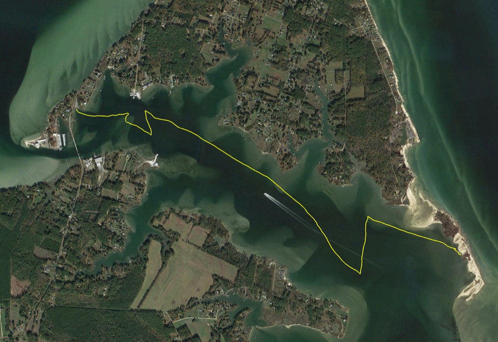
The wind was forecast to be around 10mph, but either I don’t really know what 10mph wind looks like, or it was quite a bit higher. The wind was northwesterly and it was supposed to lighten up and swing around to westerly by early afternoon, but that didn’t seem to happen either. So my trip out to the lighthouse was mostly a run, while coming back I had to beat the whole way against the wind, waves, and tide. I went 23.2 miles in exactly 5 hours, averaging 4.6 mph and I hit a max of 8.1 mph. I’ve increased the frequency of the GPS points in my tracking app, so I guess that really is about the top speed of the boat. I might be able to improve it slightly once I build a tiller extension and get the trim a little better.

My GPS track of the trip.

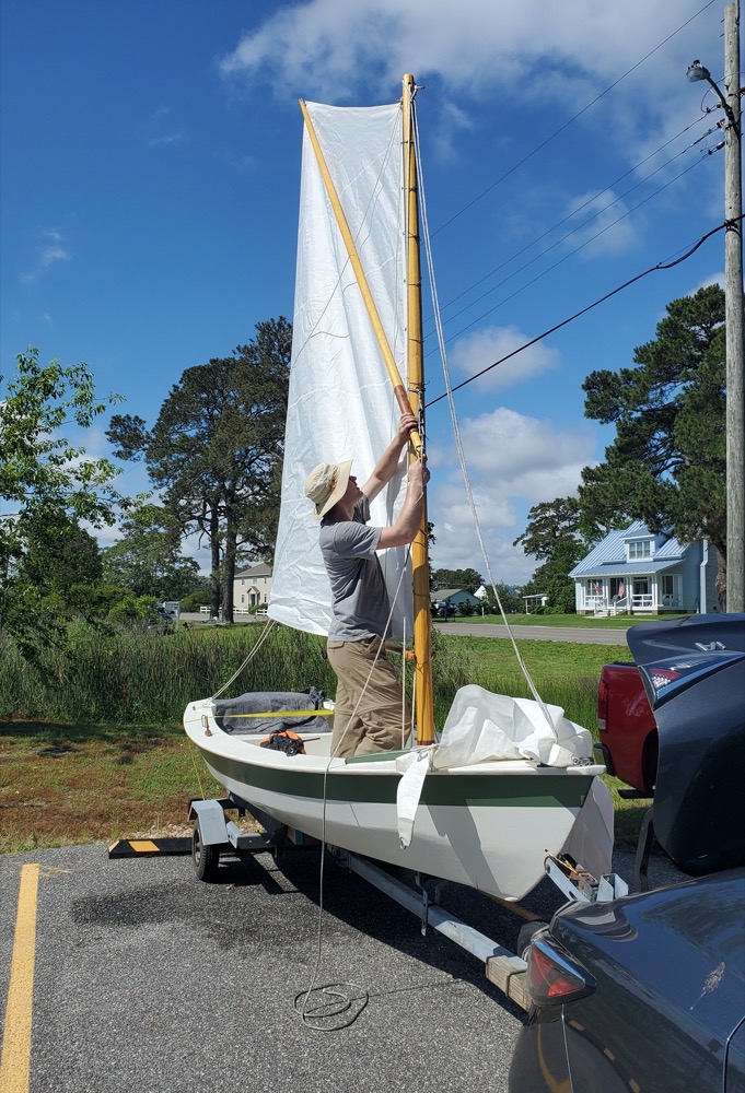
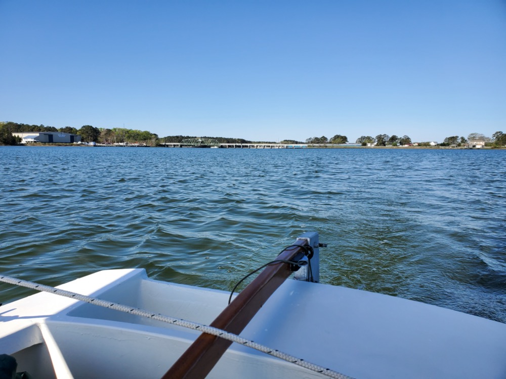
I launched from the public boat ramp at the mouth of the aptly named Put In Creek. This creek flows into the East River which flows into the Mobjack Bay. It’s a nice ramp, although the parking is a bit limited and there’s no trash cans or restrooms.

Heading down the East River past Williams Wharf. This area has a rich history from the colonial period through the steamboat era. In the 1600’s and 1700’s English goods were unloaded and tobacco was loaded to export. In the 1800’s it was an official port of entry. In the steamboat era it was a regular stop and the James Adams Floating Theatre played shows here. In the mid 1900’s it was an oil depot. In the early 2000’s the Mathews Land Conservancy bought it and they are in the process of building a huge pubic access site. There will be a boat ramp, docks, fishing pier, nature trails, and a community center building.

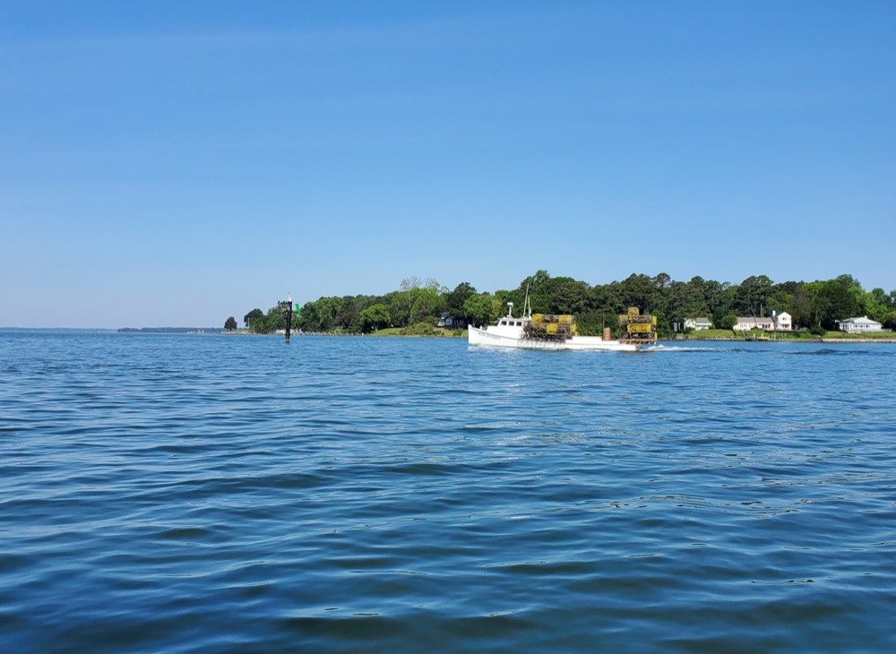
Coming up on the mouth of the the East River and the Mobjack Bay. I saw four or five crabbers out checking their pots.

Looking back up the East River. Gotta remember what those houses look like so I can find the right place to turn when I come back!

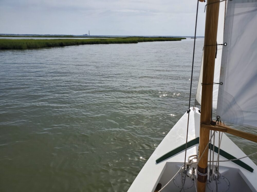
Out into the Mobjack Bay! I kind of cut the corner at the mouth of the East River and it was pretty shallow. The centerboard never hit, but I could see ripples in the sand below. Fortunately the tide was rising and I wouldn’t have to worry about shallow water coming back… right? Actually I misread the tide table and the tide was dropping. We’ll see how that went when I come back. It’s probably too small to see, but New Point Comfort Light is just to the right of the point.

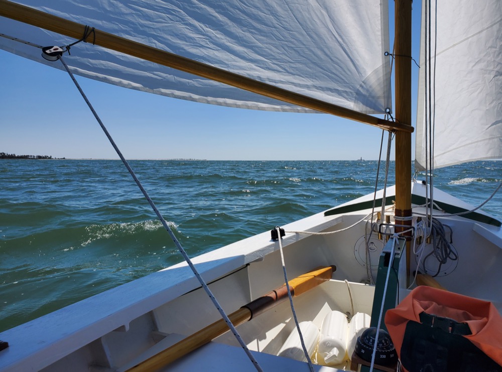
After making the turn into the Mobjack, I quickly shot down the shoreline. It was around in here where I started questioning Windy’s 10mph forecast. And to some extent my ability to get back. Since the wind was coming from the northwest, there’s about 10 miles of fetch. The waves were pretty steep and close together, but going downwind was smooth enough. A couple times I got the boat to surf down a wave for a few seconds which was exciting. Before I left I bedded the centerboard cap with some butyl rubber and I’m pleased to report that has stopped the leaking.

Getting closer! This is the last stand of trees on the peninsula before it turns into a long low marshy/sandy stretch. Just to the left of the woods out of frame is a wooden bird watching pier where I launched my canoe a few years ago to row out to the lighthouse.

I made it! I considered stopping, but there was 10 miles of fetch and I didn’t want to risk getting blown onto the riprap which was making a kind of scary crashing sound. Plus there are breaking waves off to the left where it gets shallow. I figured by the time I could get the sail brailed up and turned around into the wind to row, I’d be half a mile out into the Chesapeake. I’m glad I climbed it a few years ago so I wasn’t as tempted.

But I decided to circle it and call it a day. You can just make out the door on the bottom right. The riprap didn’t use to be nearly this high, but in 2012 Mathews County put these big boulders in place. There was a real worry the whole thing could wash away in a good hurricane. It’s still really exposed, but it’s probably better protected than it’s been since it was built.

Here are a few historical pictures and some I took when I climbed it in 2017:

In 1910 the keepers house and outbuildings were still standing. The water is starting to cut around the edge though.

By 1928 all that is left is the oil shed.

Nearly cut through by the 1950’s. You can just make out one wall of the oil shed which is still standing.

And here’s all that’s left today. The island is about 150′ x 150′ from an original 100 acres. This doesn’t show the longer dock that was built in 2016 to help restoration work sometime in the future.

The tower is made from sandstone blocks and stands 58′ tall. It’s in pretty rough shape. It’s interesting how 200+ years of sand blowing around has weathered the lower blocks way more than the top. When my wife and I landed we must have scared off 50 pelicans… everything was covered in bird poop and smelled like rotting fish.

I didn’t expect it to be open when I arrived, but somebody has ripped the lock out of the frame. There were no posted signs, so I started for the top! You can see how much the island has been built up to keep it from flooding.

Sandstone steps. There’s no handrail and you really need to be close to the wall to have enough space for your foot.

After 50 steps you make it to a wooden landing that looks to be pretty new. There’s a rusty ladder made from angle iron that leads up into the lantern room. One of the rungs has rusted through, so it’s a little sketchy.

There’s a tiny door to the balcony which is about 3′ tall and 2′ wide. Everything is rusty and covered in bird poop. I walked out onto the balcony and the railing wiggled enough that a good shove might rip it right off.

The steps are covered in loose stones and twigs that birds have brought in.

My wife took this picture of me at the top. Proof that I was there haha.

And back to today’s trip…

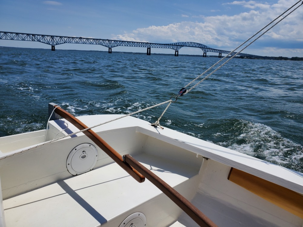
After rounding the island I started tacking back home. I pretty quickly found I had to sit on the rail to have any hope of keeping the boat upright. I’m not sure what the windspeed was, probably 20-25mph according to the Beaufort scale. I really need to figure out reefing… but it’s tough with a sprit rig. I’m thinking maybe drop the jib, then scandalize the main might be easier than trying to lower the snotter and tie in reefs. I really should practice sailing with just the main to see how it works.

This is the only picture I took until I made it back into the East River. It doesn’t look too bad, but there were a lot of whitecaps and the waves were short and steep. They seemed to be spaced about 1.5 boat lengths apart which made for a rough motion. A couple times a wave hit the side of the boat and covered me in spray and at one point a whitecap nearly broke into the boat. Fortunately she just slid up overtop of it. Looking at my GPS track, I lost about 50 feet every time I tacked, and sometimes it took a few tries to get through the wind. But when I was moving the boat averaged around 4.5-5mph.

I tried to cut the corner since I thought the tide was rising and I made it through on the way out, but I soon started hearing my centerboard bumping along the bottom. I couldn’t point up any higher and I really didn’t want to tack back into the Mobjack if I could help it. The water was quite a bit calmer through here, so I pulled in on the main sheet and used my balance to keep the leeward rail underwater. For nearly half a mile I kept the boat heeled over which kept the centerboard from hitting. Those side decks come in handy again!

Even though the water was calm compared to out in the Mobjack, tacking up the river back to the ramp was the trickiest part of the day. I’d get hit by sudden gusts of wind that would nearly put the rail under, then the wind would die just as suddenly and I’d nearly fall off the windward side from hiking. But I eventually made it back to the ramp and got the boat hauled out.

I guess the day went too well to get off without a minor disaster! Coming home I felt the trailer start to sway a bit and when I looked through the side mirror I saw a few chunks of rubber coming off. This tire was really old and starting to dry rot and I was thinking I should probably replace it. It took about 20 minutes to put the spare on and with that today’s adventure was over!


Centerboard Catch

Another improvement I’ve made is a 316 stainless steel catch and protective pad to hold the centerboard in the up position. I welded it from some 3/16″ x 1″ flat bar and 1/4″ round bar. I countersunk the mounting holes on both sides, one for the #8 screws and the other side for a wad of butyl tape. Previously I looped the line on the handle around the centerboard pivot bolt which was awkward at best.

Wolf Trap 2020

April 11th, 2020

Today was forecast to be a really nice day, so I decided I’d try again to make it to Wolf Trap light from Gwynn’s Island after my previous attempt was cut short by some serious fog. I’ve also made a few improvements to the boat which I wanted to test. I epoxied in two additional belaying pins and welded up a stainless catch for the centerboard rod.

I won’t keep you in suspense, I did make it and here’s my GPS track. It was a 21.1 mile trip!

All loaded up and ready to head to Gwynn’s Island. I get some strange looks when I pull in at the boat ramp beside a row of lifted F250’s pulling 300hp center consoles. Clearly I’m in the wrong line of business.

I launched right at low tide and I was a little worried I wouldn’t be able to get to Rigby Island since it’s so shallow. Fortunately I could rely on a rising tide throughout the day and hopefully a boost on the return trip.

This time I did a better job of brailing up the sail. I think some bungie cords might be easier to use rather than wrapping the brail line around everything. I’m starting to get better at getting everything rigged and launched without incident. From arriving to launching took 40 minutes.

Heading away from the ramp on a run. My mother was a postmaster on Gwynn’s Island and she’s told me stories of how that swing bridge would sometimes stick open. One time it jammed just before a hurricane arrived and she was worried she’d have to stay in the post office. But fortunately they got it closed again.

Towards the bottom of Gwynn’s Island I saw a number of watermen checking crab pots. Growing up I used to think I wanted to work on the river, but I bet the freezing cold or sweltering hot days would outweigh the nice days.

Heading towards Rigby Island. It was somewhere along in here where I heard an unwelcome grinding sound emanating from the centerboard. The boat speed also seemed to take a hit. Looks like I was running out of water! I need to get a jam cleat and mount it to the centerboard cap for the downhaul. Currently I just tie the line around the thwart, but that makes it hard to get the board up in a hurry.

The sandy part of the island is so low that I was having a hard time seeing it and I strayed into a shallow area. I made a turn towards shore because most of the houses had docks, so I assumed there was deep enough water.

There are a lot of sandbars in this area and with the low tide they were just barely submerged.

Navigating by the color of the water. The sandbars seem to be pretty sharply defined though.

Heading out into the bay. I found a row of PVC pipes marking a channel between islands so I followed it out rather than follow the shore further south.

There’s Wolf Trap light on the horizon! It’s a little over 5 miles away. As I got away from shore the wind started picking up. The waves were the biggest I’ve had the boat in, maybe 3′ at times but the majority were probably 2′. At one point I had waves coming from two different directions and the wind from a third… so it was an adventurous trip. The boat really handled it well.

Eventually I made it to the lighthouse. I wanted to circle it, but the wind shifted so I’d have to beat directly towards it. Everything was making me start thinking about heading back, so I decided to turn around. Maybe another time. These pictures really don’t do the waves any justice.

Aiming at what I thought was Stingray point just north of Gwynn’s Island but it turns out that was actually Windmill point. I was a little over 20º off of where I should have been going.

After checking my phone I realized I was about to miss my exit.

Heading through the hole in the wall wing and wing. Despite being ~30 yards wide in places the channel was well marked. I’ve been thinking about making a tool that is a combination whisker pole, boat hook, and mounts to the rudder head to support a tent’s ridge line.

Nearly back to the ramp. I went 21.1 miles in 5.5 hours with an average speed of 3.9mph and a max of 6.8mph. I think I need to get my GPS tracker to take more finely spaced points. It’s currently set to take a point every 2 seconds, but I can’t believe 6.8mph is the max I hit today.